Great Smoky Mountains National Park pulls in more than 12 million visits a year, more than almost any other park in the country. Most of that traffic funnels through the same two roads, Cades Cove and Newfound Gap, and never reaches the quieter corners on the North Carolina side. This guide splits the park into itineraries by day count, from a single afternoon to a full week, so you can match the plan to the time you actually have.
Every plan below assumes you're basing yourself in one of the gateway towns and driving in each day, since there's no shuttle system and cell service disappears the moment you cross into the park. Check the current road status before you leave home, especially if you're chasing waterfalls or high-elevation views in shoulder season.
How Many Days Do You Need in the Great Smoky Mountains?
One day is enough to see a single corridor of the park, not the whole thing. Three days covers the highlights most people picture when they think of the Smokies: the Cades Cove wildlife loop, the drive up to Kuwohi, and at least one waterfall trail. Five to seven days lets you add the North Carolina side, the elk fields at Oconaluftee, and quieter hikes like Big Creek that the day-trip crowd skips entirely.
The park covers about 800 square miles of ridge and valley, and driving between sections eats more time than the mileage suggests, thanks to 25-35 mph mountain roads and Cades Cove traffic. Think in corridors, not checklists — pick which side of the park you're tackling each day rather than zig-zagging across it.
| Days Available | Recommended Focus | Best For |
|---|---|---|
| 1 day | One corridor only — Cades Cove OR Newfound Gap/Kuwohi | Road-trippers passing through |
| 2-3 days | Cades Cove, Newfound Gap/Kuwohi, and Roaring Fork | First-time visitors |
| 4-5 days | Add Elkmont, Big Creek, or Deep Creek | Repeat visitors and hikers |
| 6-7 days | Full TN and NC sides plus a Mount LeConte summit | Dedicated hikers, long trips |
Before You Go: Fees, Getting There, and When to Visit
There's no entrance fee at Great Smoky Mountains National Park, a rarity among major parks, but every vehicle parked longer than 15 minutes needs a parking tag. A daily tag costs $5, a weekly tag $15, and an annual tag $40, sold online at recreation.gov, at visitor center machines, and through retail partners like REI. America the Beautiful passes don't cover this fee, though vehicles with a disability placard are exempt. Full rates and where to buy are on the park's hours and fees page.
Three entrances serve the park: Gatlinburg and Townsend on the Tennessee side, Cherokee on the North Carolina side. Fly into McGhee Tyson Airport near Knoxville and it's about an hour to the Gatlinburg entrance at Sugarlands Visitor Center; Asheville Regional Airport puts you roughly 1 hour 15 minutes from the Cherokee entrance. There's no public transit into the park, so plan on a rental car — full route breakdowns are on our directions page.
Late April through May and September into October hit the balance of good weather and manageable crowds. Summer weekends and peak fall color weeks in mid-to-late October bring the worst traffic, especially on Cades Cove Loop Road. For a month-by-month breakdown, see our guide to the best time to visit.
There's no gas station, restaurant, or grocery store inside the park. Fill the tank and pack food before you cross into Sugarlands or Oconaluftee — you won't get another chance until you're back in a gateway town.
Where to Base Yourself: Gatlinburg vs. Pigeon Forge vs. Townsend vs. Cherokee
Every itinerary in this guide assumes a home base, and where you sleep decides how early you can reach Cades Cove or Newfound Gap. Here's how the four gateway towns compare.
Gatlinburg
Gatlinburg sits about two miles from Sugarlands Visitor Center, closer to Newfound Gap Road and Roaring Fork Motor Nature Trail than any other base. It has the densest cluster of restaurants and shops of the four towns, plus distillery tastings if you want a low-key finish after a hiking day — check moonshine tours for tasting-room options. It's also the busiest and priciest option, and downtown traffic can add 20-30 minutes to an evening return.
Pigeon Forge
Pigeon Forge sits about 10 miles north of the Gatlinburg entrance and suits families splitting time between the park and Dollywood or other attractions. Rooms run cheaper here than in Gatlinburg, but every park day starts with extra drive time.
Townsend and Wears Valley
Townsend calls itself the quiet side of the Smokies, and it earns the label. It's the closest base to Cades Cove and the Tremont hiking area, with a fraction of Gatlinburg's traffic and neon. Pick it if your itinerary centers on Cades Cove, Abrams Falls, or the Middle Prong Trail.
Cherokee, NC
Cherokee sits right at the Oconaluftee entrance, making it the obvious base if your plan splits time between the Tennessee and North Carolina sides. It's also the best jumping-off point for the elk fields near the Mountain Farm Museum and the southern approach to Kuwohi.
In-Park Lodging and Camping
The only lodging inside the park boundary is LeConte Lodge, reachable solely by a hike of at least 11 miles roundtrip, with reservations that fill almost as soon as they open for the next year. If you'd rather camp, the park runs 10 frontcountry campgrounds plus more than 100 backcountry sites, most open April through October.
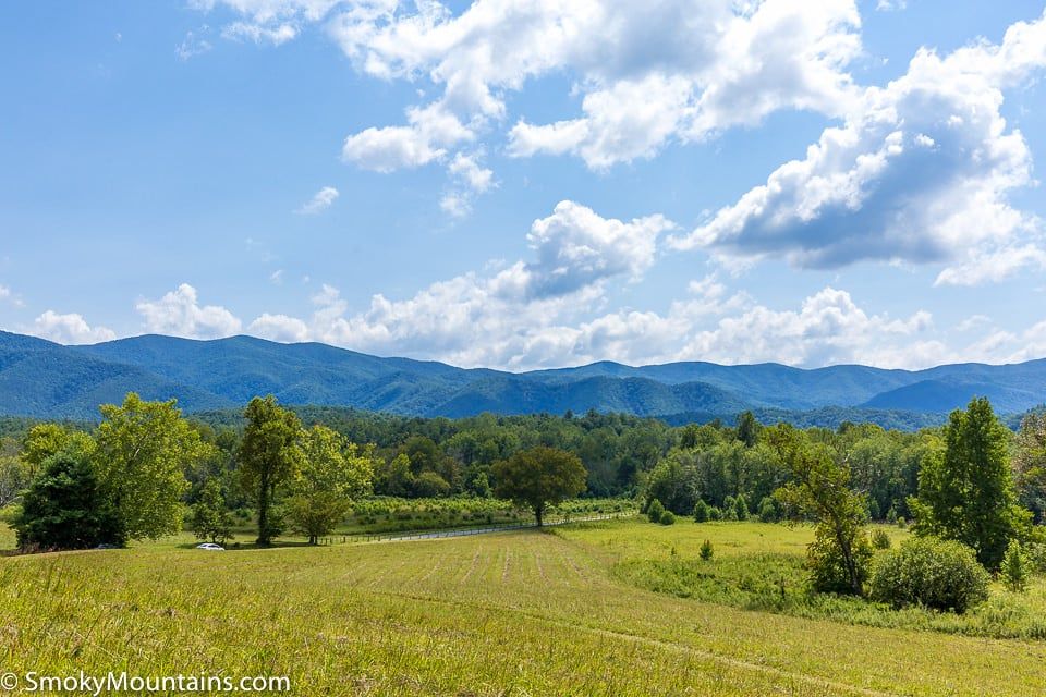
1-Day Great Smoky Mountains Itinerary
One day means picking a single corridor. Trying to combine Cades Cove and Newfound Gap Road in the same day burns most of your time driving between them.
Morning: Sugarlands to Newfound Gap
Start at Sugarlands Visitor Center for trail conditions and a short nature trail, then drive Newfound Gap Road (US-441) up to Newfound Gap itself, at 5,046 feet on the Tennessee-North Carolina line. Franklin Roosevelt dedicated the park here in 1940, and the overlook gives a clean view across both states on a clear morning.
Midday: Kuwohi
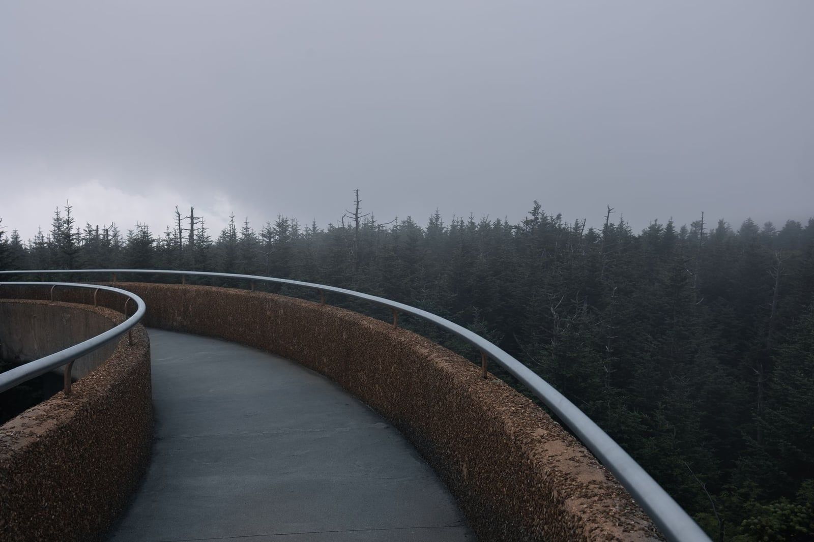
From Newfound Gap, a 7-mile spur road leads to the parking area for Kuwohi, formerly Clingmans Dome, the park's highest point at 6,643 feet. The summit trail runs only about half a mile but climbs steeply to an observation tower with 360-degree views that, on a clear day, reach past 100 miles. If the trail's too crowded or you're short on time, helicopter tours based near Gatlinburg fly the same ridgeline instead. The road up is seasonal and closes with winter snow, so check conditions outside summer and fall.
Afternoon: Choose One More Stop
With time left, either loop back toward Cades Cove for a chance at wildlife (best right after opening or in the last hour before dusk) or add a short waterfall hike near Gatlinburg, like Grotto Falls off the Trillium Gap Trail. Don't try to squeeze in both. The drive between Cades Cove and Newfound Gap Road alone runs close to an hour each way.
2-3 Day Great Smoky Mountains Itinerary (The Core Loop)
Two to three days is the sweet spot for a first visit — enough to cover the loop most people come for without the drive fatigue of cramming it into one day.
Day 1: Cades Cove
Drive the 11-mile Cades Cove Loop Road in the morning, when deer, turkeys, and the occasional black bear are most active in the open meadows. The loop passes three historic churches and the still-operating John P. Cable Mill; budget two to three hours minimum, longer if traffic backs up behind a bear sighting, which it will. On Wednesdays from May through September the loop closes to cars entirely for bikes and walkers. If you'd rather someone else navigate it, guided jeep tours run the same route.
In the afternoon, head to the nearby Tremont area for Spruce Flats Falls or the Middle Prong Trail — shorter, calmer alternatives to the falls everyone else is hiking.
Day 2: Newfound Gap Road and the North Carolina Side
Spend day two working the Newfound Gap Road corridor south to north: Sugarlands Visitor Center, the Alum Cave trailhead, Newfound Gap, and Kuwohi. Alum Cave Trail is a 4.6 to 5-mile roundtrip, moderately tough hike past Arch Rock and the Alum Cave bluffs, and it's the busiest trailhead on this road — arrive by 7:30-8am on weekends or the lot fills. Continue over the state line to Oconaluftee Visitor Center and the Mountain Farm Museum, where elk often graze the fields at dawn and dusk, then grab lunch in Cherokee before heading back.
Day 3 (Optional): Roaring Fork and the Waterfalls
Add a third day for the Roaring Fork Motor Nature Trail, a narrow 5.5-mile one-way loop near Gatlinburg lined with old-growth forest, historic cabins, and roadside cascades like the Place of a Thousand Drips. It's typically open April through November and closed to trailers, RVs, and buses. Laurel Falls, long the go-to easy waterfall hike, has been closed since January 2025 for an estimated 18-month rehabilitation and isn't expected back until at least summer 2026 — Grotto Falls, Meigs Creek, or Cataract Falls are solid substitutes.
4-7 Day Great Smoky Mountains Itinerary (Beyond the Highlights)
Beyond day three, the park opens into quieter sections most day-trippers never reach. If you want the full rundown of hikes and drives before mapping these extra days, our complete things-to-do guide covers more ground.
Day 4: Elkmont and the Little River
Elkmont was a logging camp turned early-1900s resort community before the park existed, and the National Park Service still maintains several of its cabins as a preserved ghost town. Pair it with a walk on the Little River Trail, or if it's summer, book a tubing run on the Little River near Townsend — outfitters like River Rat charge around $25 per person, with a $5 discount for booking a day ahead.
Day 5: Big Creek, the Quiet NC Side
Big Creek sits in the park's northeast corner and sees a fraction of the traffic Cades Cove does. The hike to Midnight Hole, a swimming hole below a small waterfall, runs about 3 miles roundtrip on the Big Creek Trail; push another half mile and you reach Mouse Creek Falls, dropping 45 feet into the creek.
Day 6: Deep Creek or Cataloochee
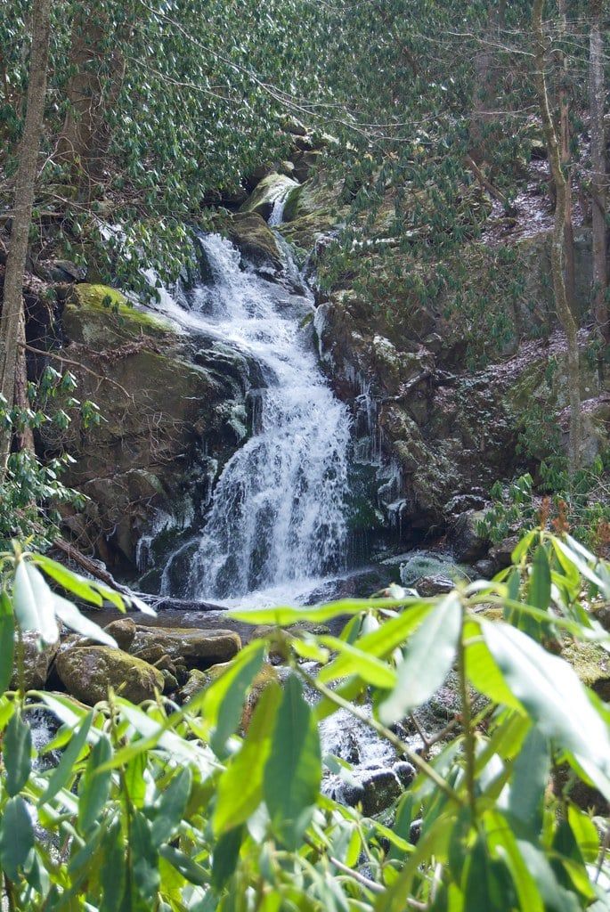
Choose between Deep Creek near Bryson City, known for its own tubing runs and a trio of waterfalls, or Cataloochee Valley, a remote pocket on the park's eastern edge where elk gather for the fall rut. Cataloochee sits at the end of a slow, winding gravel road, which keeps the crowds thin even in October.
Day 7: Mount LeConte
Summit Mount LeConte via the Alum Cave Trail for the classic Smokies hike — an 11-mile roundtrip that gains over 2,700 feet to the third-highest peak in the park. LeConte rises from a base of just 1,292 feet, making it the tallest mountain base-to-summit east of the Mississippi. Book LeConte Lodge months out if you want to split the climb over two days, or treat it as one long push. Guided hiking tours run this route for anyone who'd rather not navigate the elevation alone.
If the traffic on Cades Cove or Newfound Gap Road wears you down, the Foothills Parkway near Wears Valley delivers the same panoramic ridge views with a fraction of the cars — a good half-day add-on for any itinerary past four days.
Itinerary Add-Ons: Elk, Fireflies, Tubing, and Other Seasonal Experiences
A few experiences don't fit neatly into a day-by-day loop but are worth planning a trip around if your dates line up.
Synchronous Fireflies
Thousands of Photinus carolinus fireflies flash in unison near Elkmont for about two weeks each year, usually late May into early June. The park runs a lottery for vehicle passes during the peak window, since parking at Elkmont is otherwise closed to the public that week.
Elk Viewing
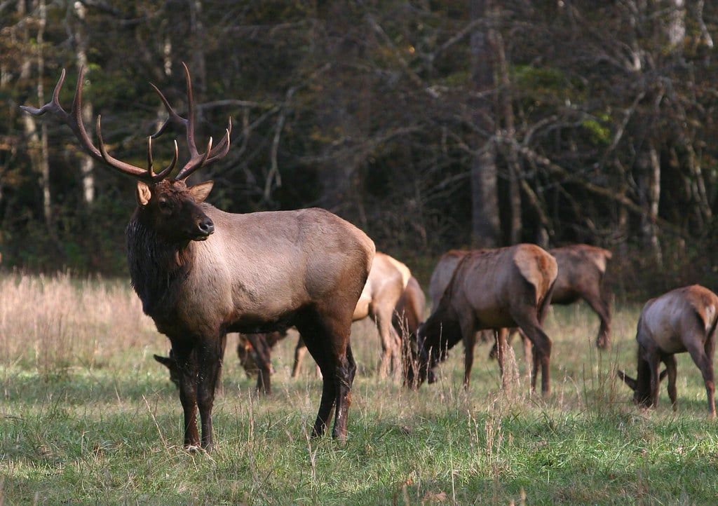
Cataloochee Valley and the fields around Oconaluftee Visitor Center are the two reliable spots for elk, best at dawn and dusk. The fall rut in October brings the most activity and the loudest bugling, but keep your distance — approaching within 50 yards of any large wildlife is a federal violation.
Tubing the Little River
Tubing runs roughly Memorial Day through Labor Day on the Little River near Townsend, outside the park boundary. It's an easy add-on to a Cades Cove day if the kids need a break from hiking.
Fall Foliage Timing
Color starts at high elevation around Newfound Gap and Kuwohi in early-to-mid October and works down to the valleys by early November. Weekends in the second half of October are the single most congested stretch of the year — visit on a weekday if you can.
Sample Printable Itinerary Table
Save or screenshot this table for a quick-reference version of the plans above, scaled to how many days you've got.
| Plan | Morning | Afternoon | Evening / Base |
|---|---|---|---|
| 1-Day | Sugarlands + Newfound Gap | Kuwohi summit trail | Cades Cove or one waterfall — pick one; base in Gatlinburg or Townsend |
| Day 1 (2-3 Day) | Cades Cove loop | Tremont waterfall | Dinner and stay in Townsend |
| Day 2 (2-3 Day) | Alum Cave trailhead | Newfound Gap + Kuwohi | Oconaluftee and Cherokee; base Cherokee or Gatlinburg |
| Day 3 (optional) | Roaring Fork Motor Nature Trail | Grotto Falls hike | Dinner and stay in Gatlinburg |
| Days 4-7 | Elkmont, Big Creek, or Deep Creek | Cataloochee or Mount LeConte | Foothills Parkway sunset; base Cherokee or Townsend |
Frequently asked questions
How many days do you need for a Great Smoky Mountains itinerary?
Plan on at least two to three days to cover Cades Cove, Newfound Gap, Kuwohi, and one waterfall hike. Add two to four more days if you want the North Carolina side, Big Creek, or a Mount LeConte summit.
Is Laurel Falls Trail open?
No. The trail closed on January 6, 2025 for an estimated 18-month rehabilitation project and isn't expected back before summer 2026. Grotto Falls, Meigs Creek, and Cataract Falls are the usual substitutes while it's closed.
Do you need a reservation or pass to enter Great Smoky Mountains National Park?
There's no entrance fee and no timed-entry reservation. You do need a parking tag for any stop over 15 minutes: $5 daily, $15 weekly, or $40 annually, sold at recreation.gov, visitor centers, and self-serve machines.
What is the best home base for a Smoky Mountains itinerary — Gatlinburg, Pigeon Forge, Townsend, or Cherokee?
Gatlinburg sits closest to Newfound Gap Road and Roaring Fork. Pigeon Forge suits families wanting Dollywood alongside the park. Townsend is quieter and nearest to Cades Cove. Cherokee works best if you're splitting time between both sides of the park.
Can you see Great Smoky Mountains National Park in one day?
Yes, but only one corridor. Pick either the Cades Cove loop or the Newfound Gap Road/Kuwohi corridor — driving between the two eats most of a day on its own.
What is Kuwohi and is it the same as Clingmans Dome?
Kuwohi is the current official name, restored in 2024, for the peak long called Clingmans Dome. At 6,643 feet it's the highest point in the park, reached by a steep, paved half-mile trail from a parking area off a 7-mile spur road.
When should I visit to avoid crowds?
Late April through May and September into October balance good weather with lighter traffic. Summer weekends and peak fall color weeks in mid-to-late October bring the worst congestion, especially on Cades Cove Loop Road.
Do I need to book tickets or timed entry for the Smokies?
No timed-entry system exists here. The only requirement is the parking tag, and trailhead lots fill on a first-come basis, so arriving by 7:30-8am is the real strategy for weekends and summer.